Ride the Arches National Park loop
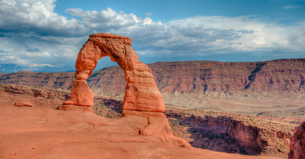
Utah’s Arches National Park is one of the country’s most magnificent natural wonders. Featuring more than 2,000 natural stone arches and other red-rock structures, it’s a popular destination for road trippers of all kinds.
While the park is a hiker hotspot, bikers can get a captivating visual tour from the seat of their motorcycles. Paved roads with sweeping curves and changing elevations will lead you through an unmatched ride.
The Arches National Park loop route map
Arches National Park is located in the southeast corner of Utah near the city of Moab. The region is accessible from four major metropolitan hubs. Depending on the direction you're traveling from, the park is approximately:
229 miles from Salt Lake City, Utah
350 miles from Denver, Colorado
381 miles from Albuquerque, New Mexico
328 miles from Flagstaff, Arizona
To begin the 36-mile motorcycle route, head to the entrance two miles north of Moab on Hwy 191. Arches National Park Road is the main route in and out of the park. At the northern end, you are diverted onto a one-way loop—Devil’s Garden Road—where you’ll find a picnic area, restrooms, and a trailhead. Follow the road around and you’ll find yourself back on Arches National Park Road heading back south.
Two other paved roads, The Windows Road and Delicate Arch Road, extend east into the park, leading to some of the park’s most famous landmarks. You can pick them up going either direction on Arches National Park Road, so you can vary your exploration of the trailheads and rock formations. Plan your trip to Arches National Park with our helpful route map.
Weather conditions along the Arches National Park loop
Arches National Park has the heaviest traffic between March and October—when you can experience mild spring and fall weather or the summer’s desert heat. You likely won’t get rained out on your Arches National Park trip due to Utah’s dry climate, but the elevation, gusty winds, flash floods, and summer heat can be imposing. Make sure you’re prepared for the day’s conditions no matter when you visit the park.
Winter can be a quieter time to visit Arches National Park due to the colder temperatures. Aside from occasional road closures to clear snow, the park is open year-round. If riding in the winter months, watch out for icy patches, especially in the shade, and make sure to pack your cold weather riding gear.
Here’s what you can expect based on average monthly temperature and precipitation in the nearby city of Moab.
Motorcycle safety tips
The heat will be one of your greatest safety concerns when visiting the park, particularly in the summer. Heat exhaustion and dehydration are the most common incidents park rangers respond to. Always pack plenty of water and wear light-colored riding gear with a lot of venting.
This route can be quite busy during peak times, so be aware of other vehicles and hikers, walkers, and families. Take your time and obey all speed limits—especially in crowded areas. If you want to pull over, wait for a designated pull-out section. This route doesn’t have shoulders on the road, so pulling over just anywhere can be hazardous.
You should also be on the lookout for wildlife, as black bears occasionally wander into the park. Large mammals, including mule deer, bobcats, and mountain lions, can also appear near the roads. The most frequently spotted animals are lizards, birds, and small mammals.
While this loop isn’t especially long, you and your bike will be in a remote area. Before you head out, check that your bike is up to the task—inspect your tires, headlights, fluid levels, etc.

Get a free motorcycle insurance quote today.
Stops to make on your Arches motorcycle road trip
When visiting the 2,000+ arches, you’ll find tons of opportunities for great riding and other exploration both in and outside the national park. See the natural wonders up close and check out these stops, all within easy driving distance.
Along Arches National Park Road
As you ride through Arches National Park, you will likely recognize some of the more famous rock formations. They are frequently photographed, and for good reason. These giant, naturally formed red-rock structures are a truly awesome sight. We’ve marked some of the must-see formations in our route map linked above.
Tower of Babel
Ring Arch
The Great Wall
Balanced Rock
Double Arch
North & South Window Arches
Turret Arch
Delicate Arch
Fiery Furnace
Sand Dune Arch
Skyline Arch
Landscape Arch
Moab, Utah
As the largest city in eastern Utah, Moab is a common hub when visiting Arches National Park. Lodging is plentiful with your choice of Airbnb accommodations, hotels, and campsites. You’ll even find some unique places to stay downtown, including a condo with a rock climbing wall inside. During peak weekends, lodging may fill up quickly, so plan ahead as much as possible. For a variety of local foods, stroll down to the Moab food truck park.
If you enjoy hiking, check out Moab trails outside the parks system. Some of the closest options to Moab are the Hidden Valley Trail and the Grandstaff Hiking Trail. However, there are over a dozen within a close distance (30 miles or less). Moab is also known for fishing, camping, and more motorcycle touring.
Canyonlands National Park
If you want to explore another national park, Canyonlands is less than 30 miles from Arches. It’s possible to hit both parks on the same day. When you arrive at Canyonlands, know where you want to go, especially if you’re on a tight schedule. This park has four districts, with Island in the Sky being the most accessible.
The entry fee is the same as Arches ($25 per motorcycle), or you can get the $55 Southeast Utah Parks Annual Pass mentioned above.
Dead Horse Point State Park
Dead Horse Point is a state park offering one of the world's most photographed landscapes—the Dead Horse Point overlook (positioned 2,000 feet above the winding Colorado River). The ride from Moab is less than 30 miles, and a paved road will take you all the way into the park. From there, you can access the Dead Horse Point lookout via a short 200-foot walk.
If you’re looking to stretch your legs on a hike, the 8-mile Rim Loop Trail is highly recommended but will take at least 3.5 hours to complete. This park costs $10 per motorcycle.
The general information in this blog is for informational or entertainment purposes only. View our blog disclaimer.
*Data accuracy is subject to this article's publication date.


